Openness
Would the scale or form of development materially reduce the open character of this land?
The proposed site lies within the South Bedfordshire Green Belt. Here is what that designation means—and what it does not mean.
National planning policy says the fundamental aim of Green Belt policy is to prevent urban sprawl by keeping land permanently open. Its essential characteristics are openness and permanence.
The five national purposes include checking unrestricted sprawl, preventing neighbouring towns from merging, safeguarding the countryside from encroachment, preserving the setting and special character of historic towns, and assisting urban regeneration.
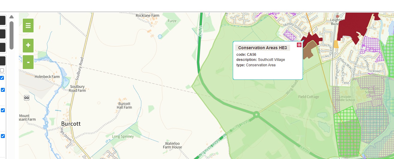
The official Central Bedfordshire policy map shows the land west of Linslade covered by the South Green Belt designation.
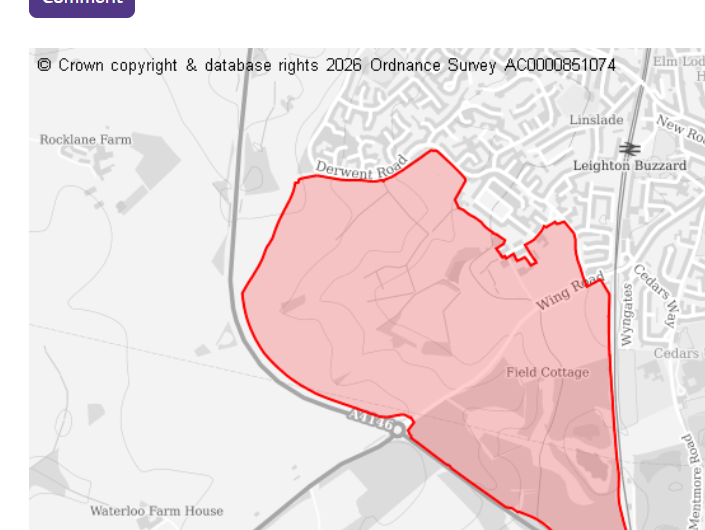
The submitted-site map defines Site 136785. The separate policy map shows the South Green Belt designation. Both should be read together.
Use only the points you understand and can express in your own words.
Would the scale or form of development materially reduce the open character of this land?
Would development extend the built-up area into countryside that is currently protected from encroachment?
Would development weaken the established western edge of Linslade or encourage outward expansion?
How would the proposal affect the relationship between Linslade, the A4146 and nearby settlements in Buckinghamshire?
Has the Council clearly demonstrated why this Green Belt site should be considered ahead of less harmful or more sustainable alternatives?
“I object to Site 136785 because it lies within the South Bedfordshire Green Belt…”
“In my view, development here would affect openness by…”
“Before considering release of this site, the Council should demonstrate…”
Wildlife observations can strengthen a response, but they should be presented under ecology, biodiversity and habitat connectivity—not as the reason the land was designated Green Belt.
Open the full response guide →Receive occasional consultation reminders, campaign updates, requests for local evidence and opportunities to help.
Scan the QR code with your phone camera or WhatsApp to join.
Announcements only. You can leave at any time.
